EMPIRIC
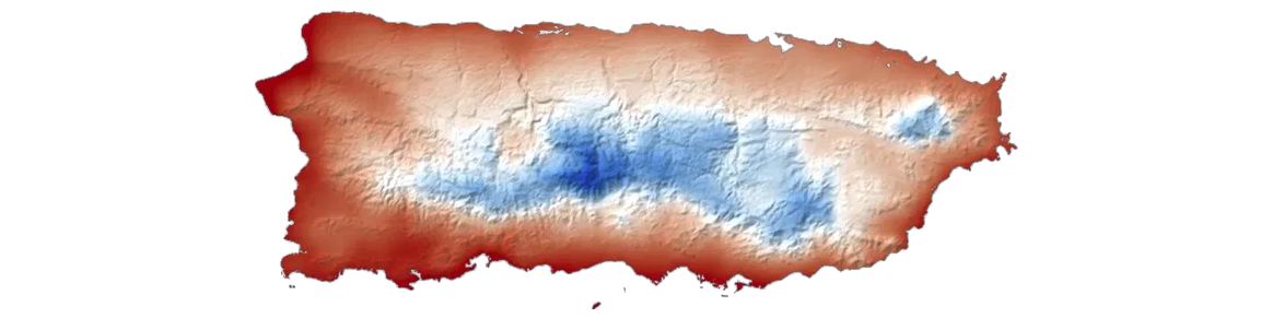
Typical global climate and weather forecast models have resolutions of 25 km or coarser, which fail to resolve the complex microclimates of islands and coastal regions. We work to build high-quality weather and climate data at the kilometer scale, focusing on site-specific hazards in concert with local stakeholders. Our focus is on understanding compound relationships between climate, weather, health, agriculture and infrastructure.
People
-

Prof. Christopher Horvat
Assistant Professor, Brown University
Sea ice floes, ice-albedo feedback, ecology under the ice, remote sensing, sub-mesoscale turbulence and its interaction with ice.
-

Dr. Paul Hall
Senior Research Software Engineer, Brown University
Mathematical modeling, scientific programming, geology, oceanography, data analysis.
-

Dr. Bingjie Zhao
Postdoctoral Researcher, Brown University
Climate change, hydrology, machine learning, remote sensing.
-

Abrielle Mannino
Graduate Student, Brown University
Tropical climate, ocean-atmosphere interactions, machine learning, co-modeling of extremes.
-
Konstantin Dichev
Undergraduate Researcher, Brown University
Machine learning.
-

Prof. Soupy
Senior Researcher
Rabbits, badgers, squirrels, running around in circles, nibbling.
Recent publications
Tools and code
-
EMPIRIC_DS
Kilometre-scale downscaling. Generative transfer learning that maps coarse meteorological fields to kilometre scale, on timescales of hours to centuries. In development.
-
EMPIRIC_TC
Tropical cyclone prediction. A Fourier Neural Operator emulator of the STORM tropical cyclone model. Produces site-specific cyclone hazard for the South Pacific in seconds.
PaperCode and trained models (Zenodo, v1.2)Source codeCode updated
-
OPT
Optimal extreme statistics. The Optimal Path Threshold method determines the optimal characterization of extremes, with applications in human health, sea ice loss, evaporation, and agriculture.
PaperSource codeCode updated
-
EMPIRIC_SDS
Spatial decision support. A web GIS platform showing site-specific hazard and uncertainty alongside health-facility data. Pre-alpha.
-
Risk outlooks for coastal regions
Sub-seasonal forecasting of extremes. OPT-enabled forecasting of compound extreme climate events on sub-seasonal timescales: a short-term prediction and early warning system for extremes and their health impacts. Prototype.
Rhode Island prototypeSource codeCode updated
-
TAC-to-IWXXM
Future-proofing meteorological data. Converts aviation weather messages (METAR, SPECI, TAF, SIGMET) from traditional alphanumeric code to the WMO IWXXM standard, with validation. In production.
Web appSource codeCode updated
Support
- Climate Change AI, 2023 Innovation Grant: EMPIRIC_AI: AI-enabled Ensemble Projections of Cyclone Risk for Health Infrastructure in Pacific Island Countries and Territories
- U.S. National Science Foundation, RISE 2528950: C2H2 EAGER: Site-specific Climate Risks to South Pacific Health and Health Infrastructure
- CHAIRS-C, Brown University School of Public Health, Pilot Grant: Robust Associations between Multi-Type Compound Extreme Events and Older Adult Health
- Brown University Office of Sustainability & Resiliency, 2025 Sustainability Seed Grant: Tracking and Forecasting Health Impacts of Compound Extreme Climate Impacts in the Providence Area